OBJAVUJEME
SKRYTÉ SVETY
OBJAVUJEME
SKRYTÉ SVETY

Collections of the Holocaust Museum in Sereď, Slovakia
Project:
- Topographical survey of the Holocaust Museum for a further building condition diagnostics project and structural analysis of the building in cooperation with a registered architect
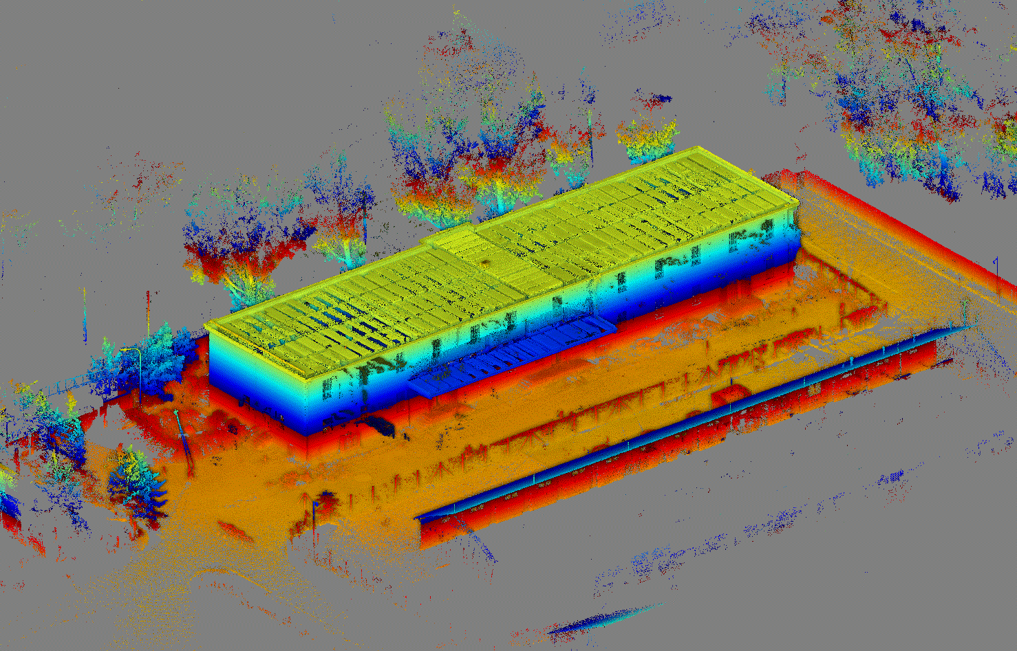
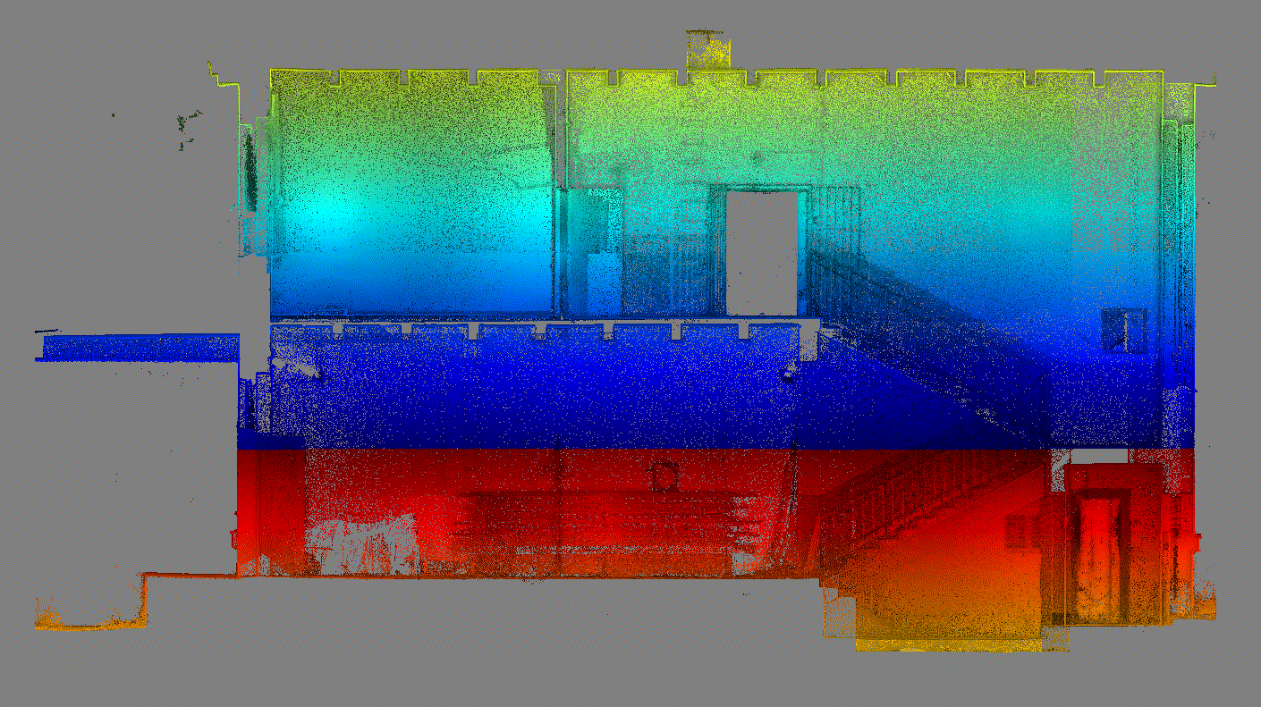
- Complete scanning of the exterior and interior of the building, black-and-white scanning


.jpg)


Technology:
- Raw data imports
- Registration based on ground control points
- Georeferencing of a point cloud in a binding coordinate and altitude system (S-JTSK, Bpv)
- Point cloud classification (Trimble RealWorks 11.2)
- Data block segmentation and clearance
- Generating building sections and elevations, point/line exports
- 3D point cloud preview
- Drawings (Bentley MicroStation Connect Edition)


Outputs:
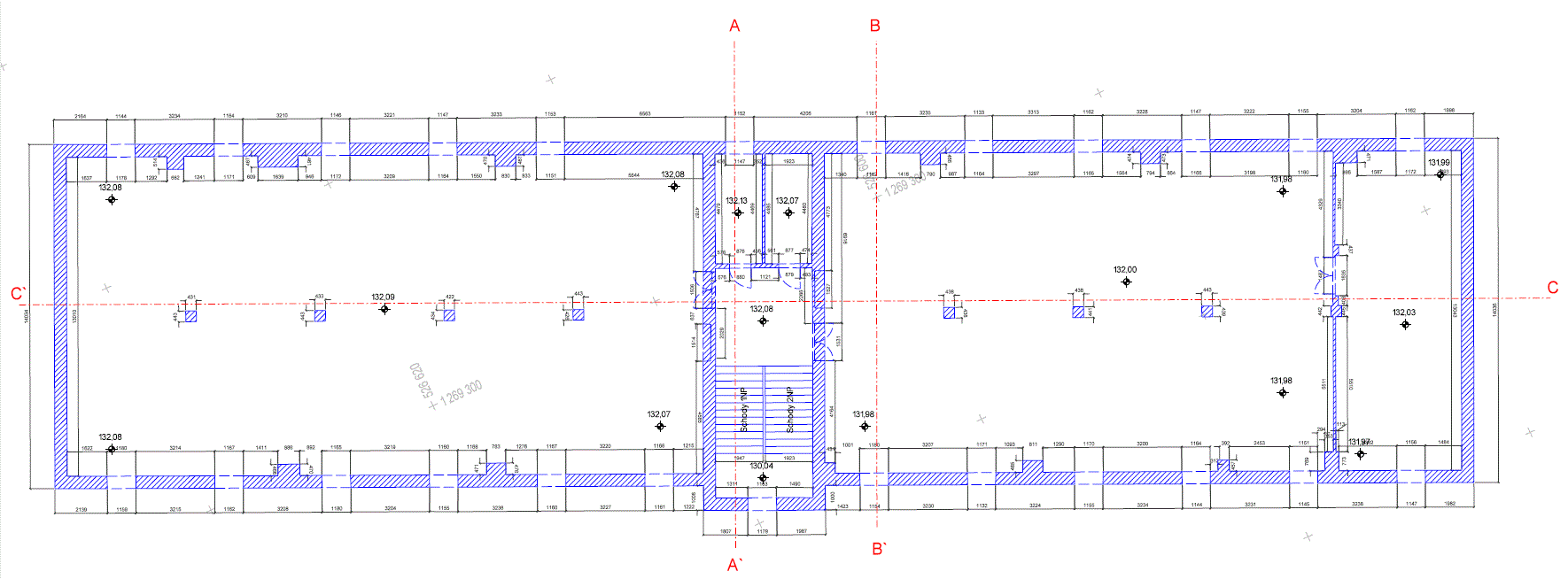
- Floor plan drawings
- Vertical sections
- Elevations
- Point cloud relative adjustment accuracy σYXZ=12.00 mm
- Absolute accuracy σYX ≤ 15.00 mm, σZ ≤ 15.00 mm
- 97 scanning positions